
This release introduces a new app-wide dark mode, route rejoin guidance, Safety Check-ins, rebuilt offline experiences, offline map additions and the Activity Story Designer.
Dark mode across the whole app
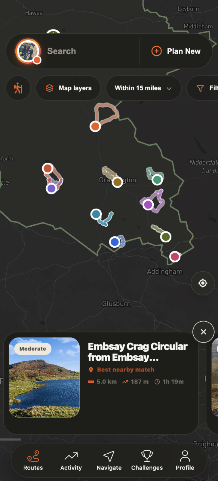
- Full app-wide dark mode now covers the main Home, Routes, Activity, Community, Challenges and Profile experiences - not only maps.
- Cards, sheets, menus, search fields, buttons, charts, alerts and navigation controls now use adaptive dark surfaces with improved contrast.
- Standard maps switch to Mapbox Dark in dark mode across route discovery, route details, weather, completed activities, peaks, landmarks, challenges, sharing and route creation.
- Route Controller and Route Drawer map pickers now offer Dark, Normal and Satellite, and remember the chosen appearance.


Navigation
- Guidance back to the route: get directions to the route start or rejoin the route from your current position. You can recalculate the guidance, return to the original route view or stop rejoining.
- Upcoming directions: open a clear list of the turns ahead while following a route.


Safety Check-ins
- Premium users can choose a trusted contact and set an expected finish time from Route Tools.
- The suggested finish time uses live walking pace when available, otherwise the route’s planned duration or distance.
- An armed indicator remains visible above the route statistics and can be tapped to manage the check-in.
- Extend an active check-in by 30 minutes or cancel it when it is no longer needed.


Rebuilt offline pages and downloads
- The bundled offline versions of Home, Routes, Activity, Community, Challenges and Profile now match the main app’s design and dark mode.
- Offline Activity and Profile use locally cached account information so useful content remains available without a connection.
- Downloaded Routes and downloaded regions have clearer cards, search and tabs, improved empty states and consistent dark styling.
- Starting or deleting a downloaded route, deleting a region and deleting all downloads now use Go Guide-styled confirmation sheets.
- Downloaded route and region content is protected behind verified Premium access. Free accounts see a clear offline message without cached Premium route data being exposed.
- Offline map downloads follow the selected map appearance. Previously downloaded light regions may need downloading again for a fully offline dark map.
- Add map items while offline: hazards, places, viewpoints, peaks, waterfalls, photo spots and other map additions can now be saved without signal.
- Offline additions appear on the map immediately and are stored on the phone, including an optional photo. They upload when connection returns, the app becomes active or the activity finishes.

Route Map and Route Drawer improvements
- Route Drawer now visually matches the main route controller with larger circular controls, a clearer Tap/Draw selector, stronger Save action and adaptive chart styling.
- The old Tap/Draw instruction banners have been removed to leave more room for the map.
- Searching for a route now focuses the map and carousel on that result; closing search returns to the normal nearby-route view.
- Floating location, Premium and map-style controls move with the route sheet instead of being covered as it expands.

New Activity Story Designer
- Turn a completed route or Track & Go activity into a shareable story image.
- Choose a ready-made design or create one with a photo, colour or map background.
- Add activity stats, route and elevation graphics, text, dates, stickers and profile details, then move and resize each element.
- Save or share the final design. Story viewers now show the creation date and time for each individual story.
Choose a completed activity and open its sharing options to start designing.

